
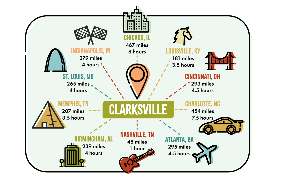
Maps & Transportation
Clarksville is a vibrant and historic Middle Tennessee community located along I-24, 45 minutes northwest of Nashville, at the TN/KY border.
Getting Here:
Air: With more than 18 million passengers visiting each year, the Nashville International Airport (BNA) serves 540 flights daily to 75 nonstop markets.
Clarksville is approximately 40 minutes from BNA, where travel options include rental car, airport shuttle services, taxi/limo, Groome, Uber and Lyft.
Highway: I-24 runs diagonally through Montgomery County with four major interchanges at Exit 1, 4, 8 and 11. Most of the city’s hotels and nationally known retailers are located at Exit 4.
For those who prefer the scenery and experiences of back roads highway over interstate travel, you’re in luck. US Highways 79, 41, 41-A, and 76 enter the city from its perimeter and dozens of state highways also intersect the county.
Bus: Greyhound Bus offers service from 2249 Lowe’s Drive (931-647-3336).
Getting Around:
Clarksville Transit Authority offers local bus services with 10 routes along the city’s major thoroughfares. Digital bus passes are available through the Token Transit App. Taxi, Uber and Lyft services are also available in the city.
Downtown Parking:
ParkMobile parking services are available in downtown Clarksville. Through the app, users can able to pay for street or garage parking, find open spots based on their location, track how much time their spot has left, and more, all without having to use a meter or kiosk. ParkMobile will service 234 on and off-street spaces throughout the downtown area.
The ParkMobile app is available on both the Apple Store and the Google Play Store.